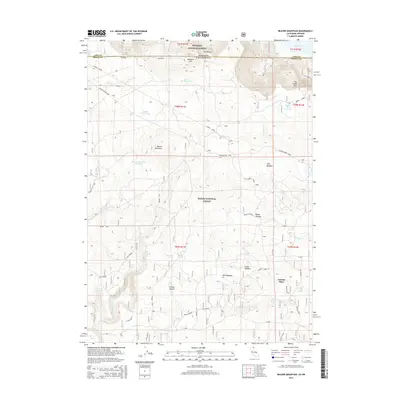
2015 Map of Beaver Mountain
USGS Topo · Published 2015About this map
Grizzlie Place sits at the heart of this high-elevation landscape, where the northern border of Modoc National Forest meets the Fremont National Forest at the Oregon-California state line. The terrain is defined by a series of volcanic features and meadows, including Muldoon Mtn and Beaver Mountain. A sophisticated network of water management is evident through numerous named tanks and reservoirs, such as the Beaver Mountain Reservoir and Oregon Rim Reservoir, which support the region's ranching and forestry needs. Industrial access is provided by several named routes, most notably Weyerhaeuser Road and the Crowder Flat Spur. Numerous named springs like Coffee Mill Spring and Rail Spring indicate the critical importance of water sources in this high country of Modoc County, while features like Grassy Ravine and Rail Meadow highlight the varied grazing lands used during this era.
Find a feature on this map
38 named features on this map. Tap any name to fly to it.
Don’t see what you’re looking for? This feature index may not catch every label — zoom into the map to look around manually.
Map Details
Editions of this 2015 Beaver Mountain Map
This is the sole edition of this map. No revisions or reprints were ever made.
Other maps of this area

1886 · Alturas
USGS Topo · 1:250,000

1892 · Alturas
USGS Topo · 1:250,000

1954 · Alturas
USGS Topo · 1:250,000

1955 · Klamath Falls
USGS Topo · 1:250,000

1958 · Alturas
USGS Topo · 1:250,000

1958 · Klamath Falls
USGS Topo · 1:250,000

1960 · Strawberry Butte
USGS Topo · 1:62,500

1962 · Alturas
USGS Topo · 1:250,000

1962 · Steele Swamp
USGS Topo · 1:62,500

1962 · South Mountain
USGS Topo · 1:62,500