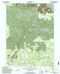
1993 Map of Beaver Mountain
USGS Topo · Published 1996About this map
Muldoon Mtn and the high ridges of the Rim dominate this high-altitude landscape along the border where Oregon and California meet. Managed as part of the Fremont National Forest and Modoc National Forest, the terrain is defined by a complex network of forest routes such as 47n02 and 48n06 that connect remote outposts and seasonal encampments. Notable evidence of early land use is found at the Grizzly Place (Site) and the Beaver Dam Cabin, suggesting a history of ranching or forestry operations in the meadows and ravines.
Find a feature on this map
76 named features on this map. Tap any name to fly to it.
Don’t see what you’re looking for? This feature index may not catch every label — zoom into the map to look around manually.
Map Details
Editions of this 1993 Beaver Mountain Map
This is the sole edition of this map. No revisions or reprints were ever made.
Other maps of this area

1886 · Alturas
USGS Topo · 1:250,000

1892 · Alturas
USGS Topo · 1:250,000

1954 · Alturas
USGS Topo · 1:250,000

1955 · Klamath Falls
USGS Topo · 1:250,000

1958 · Alturas
USGS Topo · 1:250,000

1958 · Klamath Falls
USGS Topo · 1:250,000

1960 · Strawberry Butte
USGS Topo · 1:62,500

1962 · Alturas
USGS Topo · 1:250,000

1962 · Steele Swamp
USGS Topo · 1:62,500

1962 · South Mountain
USGS Topo · 1:62,500