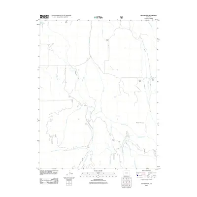
2011 Map of Beaver Park
USGS Topo · Published 2011About this map
Beaver Park serves as a central point in this Dolores County landscape, characterized by an intricate network of irrigation systems and high-altitude water management. The terrain is defined by the complex hydrology of Beaver Creek and its many tributaries, including Middle Beaver Creek and East Beaver Creek. This area illustrates the historical importance of water rights in Colorado, evidenced by the Gurley Ditch, Old Nelson Ditch, and West Beaver Highline Ditch that traverse the slopes near Big Baldy. Remote outposts such as Taylor Camp and Marie Scott Camp are situated amongst the drainage basins of Turner Creek and Saltado Creek. Further south, Dempsey Meadows and Beaver Mesa provide clear landmarks within the watershed, while specialized locations like Ditch Camp highlight the labor-intensive nature of maintaining these vital water channels.
Find a feature on this map
48 named features on this map. Tap any name to fly to it.
Don’t see what you’re looking for? This feature index may not catch every label — zoom into the map to look around manually.
Map Details
Editions of this 2011 Beaver Park Map
This is the sole edition of this map. No revisions or reprints were ever made.
Other maps of this area

1953 · Dolores Peak
USGS Topo · 1:24,000

1953 · Placerville
USGS Topo · 1:24,000

1953 · Little Cone
USGS Topo · 1:24,000

1956 · Cortez
USGS Topo · 1:250,000

1956 · Moab
USGS Topo · 1:250,000

1958 · Cortez
USGS Topo · 1:250,000

1959 · Cortez
USGS Topo · 1:250,000

1959 · Moab
USGS Topo · 1:250,000

1960 · Moab
USGS Topo · 1:250,000

1962 · Moab
USGS Topo · 1:250,000