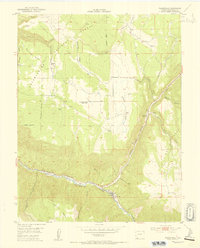
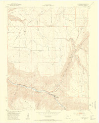
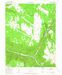
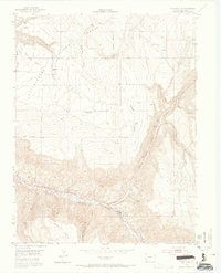
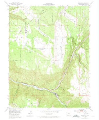
1953 Map of Placerville
USGS Topo · Published 1954About this map
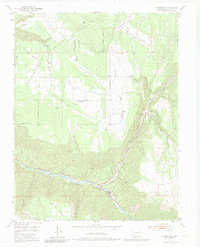
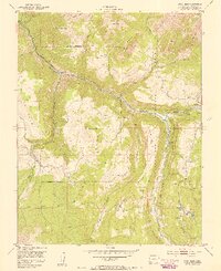
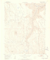
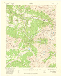
Placerville sits at the confluence of Leopard Creek and the San Miguel River, serving as a focal point for the ranching and mining activity in this corner of the Uncompahgre National Forest. The landscape is defined by high mesas, including Iron Springs Mesa and Hastings Mesa, which are incised by deep drainage systems like San Miguel Canyon and Leopard Canyon. Evidence of earlier settlement and industry is scattered across the uplands, most notably at the Iron Springs Mesa School (Aband) and the deserted site of Leonard (Aband). Industrial infrastructure is particularly concentrated near the river, where an Aerial Tramway and the Omega Mine indicate the area's mid-century mineral production. This survey, conducted in cooperation with the United States Atomic Energy Commission, reflects the region's importance during the uranium and vanadium mining era, showing how narrow canyons were utilized for transport between isolated mesa-top communities and riverfront processing routes.
Find a feature on this map
73 named features on this map. Tap any name to fly to it.
Don’t see what you’re looking for? This feature index may not catch every label — zoom into the map to look around manually.
Map Details
Editions of this 1953 Placerville Map
6 editions found
Other maps of this area

1897 · Telluride
USGS Topo · 1:62,500

1904 · Telluride
USGS Topo · 1:62,500

1909 · Montrose
USGS Topo · 1:125,000

1911 · Montrose
USGS Topo · 1:125,000

1945 · Durango
USGS Topo · 1:250,000
1953 · Gray Head
USGS Topo · 1:24,000
1953 · Little Cone
USGS Topo · 1:24,000

1953 · Durango
USGS Topo · 1:250,000

1954 · Durango
USGS Topo · 1:250,000
1955 · Telluride
USGS Topo · 1:62,500