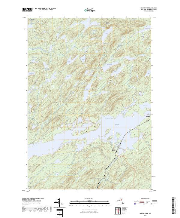
2023 Map of Beaver River
USGS Topo · Published 2023About this map
Beaver River sits at the heart of this landscape, positioned along the southern banks of the Stillwater Reservoir. This area is defined by an intricate network of waterways and glacial ponds, from Salmon Lake and Witchhopple Lake in the interior to Gun Harbor on the reservoir's edge. The presence of numerous named water bodies, including Upper Beech Ridge Pond and Lost Island Pond, reflects a terrain where water dictates movement and settlement. Navigation through this lake-rich region relies on established pathways such as the Red Horse Trl and Norridgewock Trl, which connect the remote interior ponds to the central reservoir. The northern reaches are shaped by the Middle Branch Oswegatchie River, while the southern area is marked by Little Rapids. This survey captures the modern character of this Adirondack region, where the balance between the vast reservoir and smaller secluded lakes like Ginger Pond and Hidden Lake remains the primary geographical feature.
Find a feature on this map
42 named features on this map. Tap any name to fly to it.
Don’t see what you’re looking for? This feature index may not catch every label — zoom into the map to look around manually.
Map Details
Editions of this 2023 Beaver River Map
This is the sole edition of this map. No revisions or reprints were ever made.
Other maps of this area

1903 · Big Moose
USGS Topo · 1:62,500

1912 · Number Four
USGS Topo · 1:62,500

1915 · Number Four
USGS Topo · 1:62,500

1916 · Oswegatchie
USGS Topo · 1:62,500

1918 · Oswegatchie
USGS Topo · 1:62,500

1919 · Cranberry Lake
USGS Topo · 1:62,500

1921 · Cranberry Lake
USGS Topo · 1:62,500

1931 · Cranberry Lake
USGS Topo · 1:62,500

1948 · Ogdensburg
USGS Topo · 1:250,000

1950 · Utica
USGS Topo · 1:250,000