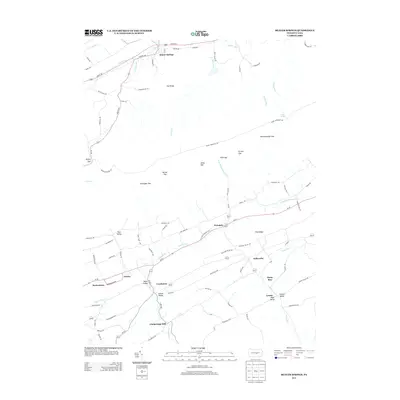
2013 Map of Beaver Springs
USGS Topo · Published 2013About this map
Beaver Springs anchors the northern portion of this landscape, situated along Beaver Cr and Route 522 beneath the prominent slopes of Ore Ridge. The geography is defined by a series of parallel ridges and valleys characteristic of central Pennsylvania, with Shade Mountain forming a massive central barrier. To the south, a network of small agricultural settlements including Evendale, Kellerville, and Cocolamus are linked by local routes like Pa-35. The presence of Gimberlings Mill on Cocolamus Cr points to a history of water-powered industry in the region's fertile valleys. Numerous mountain gaps such as Romig Gap, Botteiger Gap, and Varner Gap provide the primary passage through the high terrain, connecting the secluded lowlands of Slim Valley and Leister Valley to the broader regional road network.
Find a feature on this map
92 named features on this map. Tap any name to fly to it.
Don’t see what you’re looking for? This feature index may not catch every label — zoom into the map to look around manually.
Map Details
Editions of this 2013 Beaver Springs Map
This is the sole edition of this map. No revisions or reprints were ever made.
Other maps of this area

1907 · Millerstown
USGS Topo · 1:62,500

1925 · Mifflintown
USGS Topo · 1:48,000

1934 · Mifflintown
USGS Topo · 1:62,500

1937 · Mifflintown
USGS Topo · 1:62,500

1937 · Millheim
USGS Topo · 1:48,000

1938 · Mifflinburg
USGS Topo · 1:48,000

1941 · Millheim
USGS Topo · 1:62,500

1943 · Millerstown
USGS Topo · 1:62,500

1943 · Mifflinburg
USGS Topo · 1:62,500

1950 · Harrisburg
USGS Topo · 1:250,000
Featured Places
- Beaver Springs, Spring Township
- West Perry Township, PA
- Fayette Township, PA
- Gimberlings Mill, Delaware Township
- Spring Township, PA