
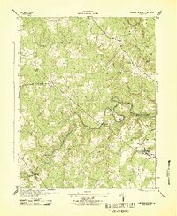
1942 Map of Beaverdam
USGS Topo · Published 1961About this map
The Chesapeake and Ohio railroad corridor serves as the primary artery through this rural landscape in the 1940s, connecting the village of Beaverdam to smaller outlying points like Tylers and Bumpass. The terrain is characterized by a dense network of watercourses, including the North Hanna River along the northern border and the winding paths of Holland Creek and Beaverdam Creek. Local life at this time centered around community nodes such as Lazarus Chapel and Union Branch Ch, alongside educational centers like the Beaverdam Sch and Aaron Hall Sch. The presence of these dispersed rural institutions, together with the numerous unpaved roads and forest cover, reflects a traditional Virginia agricultural economy still largely defined by its topography and the rhythms of the steam rail era.
Find a feature on this map
23 named features on this map. Tap any name to fly to it.
Don’t see what you’re looking for? This feature index may not catch every label — zoom into the map to look around manually.
Map Details
Editions of this 1942 Beaverdam Map
This is the sole edition of this map. No revisions or reprints were ever made.
Other maps of this area

1887 · Spottsylvania
USGS Topo · 1:125,000

1890 · Goochland
USGS Topo · 1:125,000

1892 · Spottsylvania
USGS Topo · 1:125,000

1892 · Goochland
USGS Topo · 1:125,000

1942 · Ladysmith
USGS Topo · 1:31,680

1942 · Partlow
USGS Topo · 1:31,680

1942 · Contrary Creek
USGS Topo · 1:31,680

1942 · Buckner
USGS Topo · 1:24,000

1943 · Mabelton
USGS Topo · 1:31,680
1943 · Hanover Academy
USGS Topo · 1:31,680