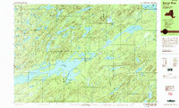
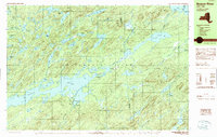
1989 Map of Beavers River
USGS Topo · Published 1989About this map
Stillwater Reservoir dominates the heart of the Adirondack landscape in this 1989 provisional survey, serving as the central waterway for the remote settlements of Beaver River and Norridgewock. The map illustrates a region defined by its complex hydrology, where Loon Lake, Big Burnt Lake, and dozens of smaller ponds like Witchhopple Lake are tucked between high peaks such as Mt Electra and Silt Mtn. This area in northern Herkimer County reflects a specific moment in the late 20th century where traditional access was shifting; while the Old Railroad Grade traces a path through the woods past Keepawa and Brandreth, the landscape remains largely defined by its interior water routes and isolated outposts. The detailed contouring around Falls Lake and the Beaver River itself highlights the varied elevations of the Adirondack Park, showing a territory where human presence is clustered at the water's edge and along former rail corridors.
Find a feature on this map
64 named features on this map. Tap any name to fly to it.
Don’t see what you’re looking for? This feature index may not catch every label — zoom into the map to look around manually.
Map Details
Editions of this 1989 Beavers River Map
2 editions found
Other maps of this area

1903 · Big Moose
USGS Topo · 1:62,500

1903 · Raquette Lake
USGS Topo · 1:62,500

1907 · Tupper Lake
USGS Topo · 1:62,500

1912 · Number Four
USGS Topo · 1:62,500

1915 · Number Four
USGS Topo · 1:62,500

1916 · Oswegatchie
USGS Topo · 1:62,500

1918 · Oswegatchie
USGS Topo · 1:62,500

1919 · Cranberry Lake
USGS Topo · 1:62,500

1921 · Cranberry Lake
USGS Topo · 1:62,500

1931 · Cranberry Lake
USGS Topo · 1:62,500