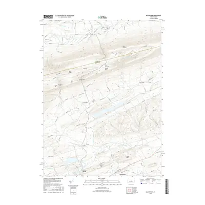
2016 Map of Beavertown
USGS Topo · Published 2016About this map
Jacks Mountain and Penns Creek Mtn dominate the landscape of central Pennsylvania in this 2016 survey, defining a valley defined by the long ridges of the Appalachian Mountains. The boundary between Union Co and Snyder Co runs along these heights, where the Middle Ridge Trail follows the spine of Mid Ridge. In the lowlands, the settlement pattern is shaped by the winding courses of Penns Creek to the north and Middle Creek to the south. Central to this area is Walker Lake, which sits between the rural hamlets of Troxelville and Benfer. The map provides detailed placement of local landmarks including the Union Cem, Gilfert Airport, and the larger communities of Beavertown and Beaver Springs, reflecting a region where agriculture and small-town centers remain anchored to the narrow valleys.
Find a feature on this map
92 named features on this map. Tap any name to fly to it.
Don’t see what you’re looking for? This feature index may not catch every label — zoom into the map to look around manually.
Map Details
Editions of this 2016 Beavertown Map
This is the sole edition of this map. No revisions or reprints were ever made.
Other maps of this area

1907 · Millerstown
USGS Topo · 1:62,500

1925 · Mifflintown
USGS Topo · 1:48,000

1934 · Mifflintown
USGS Topo · 1:62,500

1937 · Mifflintown
USGS Topo · 1:62,500

1937 · Millheim
USGS Topo · 1:48,000

1938 · Mifflinburg
USGS Topo · 1:48,000

1941 · Millheim
USGS Topo · 1:62,500

1943 · Millerstown
USGS Topo · 1:62,500

1943 · Mifflinburg
USGS Topo · 1:62,500

1950 · Harrisburg
USGS Topo · 1:250,000