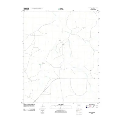
2010 Map of Becenti Lake
USGS Topo · Published 2010About this map
Kim-me-ni-oli Wash and Seven Lakes Wash dominate the drainage patterns of this high-desert landscape in the Eastern Navajo Agency. This 2010 survey highlights a sparse but organized settlement pattern, centered around localized hubs like Benally, Wilcoxon, and the Navajo Tribe Ranch. Water management is critical in this arid environment, evidenced by the presence of Becenti Lake and the engineering of the Pressley Jacobs Dam. The map also captures the distinct industrial or residential naming convention at Noserock Number One and Noserock Number Two. Modern transit is represented by the path of Rte 09, which serves as a primary artery through these lands, connecting the dispersed ranches and settlements of this high-plateau region.
Find a feature on this map
10 named features on this map. Tap any name to fly to it.
Don’t see what you’re looking for? This feature index may not catch every label — zoom into the map to look around manually.
Map Details
Editions of this 2010 Becenti Lake Map
This is the sole edition of this map. No revisions or reprints were ever made.
Other maps of this area

1883 · Mt. Taylor
USGS Topo · 1:250,000

1886 · Wingate
USGS Topo · 1:250,000

1886 · Mt. Taylor
USGS Topo · 1:250,000

1892 · Wingate
USGS Topo · 1:250,000

1892 · Mt. Taylor
USGS Topo · 1:250,000

1899 · Mt. Taylor
USGS Topo · 1:250,000

1954 · Gallup
USGS Topo · 1:250,000

1958 · Gallup
USGS Topo · 1:250,000

1958 · Albuquerque
USGS Topo · 1:250,000

1959 · Gallup
USGS Topo · 1:250,000