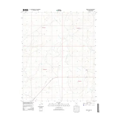
2013 Map of Becenti Lake
USGS Topo · Published 2013About this map
Kim-me-ni-oli Wash and Seven Lakes Wash define the drainage patterns across this high desert landscape within the Eastern Navajo Agency. The map documents sparse rural settlements and land use, including the Navajo Tribe Ranch and the small locales of Benally and Wilcoxon. These points of interest are connected by the primary thoroughfare, Nm-57, which cuts diagonally through the southern sections. The eponymous Becenti Lake serves as a central landmark in a region primarily organized by the Public Land Survey System, as evidenced by the township and range boundaries like t19n r12w and t18n r11w. This survey provides a precise record of the road network and water features crucial for ranching and residency in the New Mexico interior.
Find a feature on this map
11 named features on this map. Tap any name to fly to it.
Don’t see what you’re looking for? This feature index may not catch every label — zoom into the map to look around manually.
Map Details
Editions of this 2013 Becenti Lake Map
This is the sole edition of this map. No revisions or reprints were ever made.
Other maps of this area

1883 · Mt. Taylor
USGS Topo · 1:250,000

1886 · Wingate
USGS Topo · 1:250,000

1886 · Mt. Taylor
USGS Topo · 1:250,000

1892 · Wingate
USGS Topo · 1:250,000

1892 · Mt. Taylor
USGS Topo · 1:250,000

1899 · Mt. Taylor
USGS Topo · 1:250,000

1954 · Gallup
USGS Topo · 1:250,000

1958 · Gallup
USGS Topo · 1:250,000

1958 · Albuquerque
USGS Topo · 1:250,000

1959 · Gallup
USGS Topo · 1:250,000