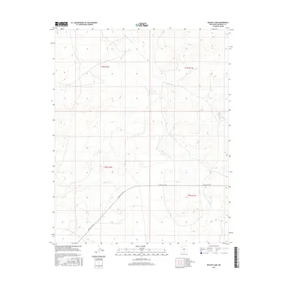
2017 Map of Becenti Lake
USGS Topo · Published 2017About this map
Becenti Lake serves as a focal point in this high-desert landscape within New Mexico's McKinley County. The topography is defined by significant drainage systems, including the north-flowing Kim-me-ni-oli Wash and the meandering Seven Lakes Wash. This 2017 survey illustrates a sparsely settled region where modern infrastructure is represented by Navajo Svc Rte 9, which arcs through the southern half of the quadrangle. The map detail reflects the arid character of the Eastern Navajo Agency, showing how natural water features and primary service routes dictate the movement and settlement patterns across the grid of township boundaries. Local historians can trace the specific path of these washes as they interact with the established roadway network in this corner of the state.
Find a feature on this map
8 named features on this map. Tap any name to fly to it.
Don’t see what you’re looking for? This feature index may not catch every label — zoom into the map to look around manually.
Map Details
Editions of this 2017 Becenti Lake Map
This is the sole edition of this map. No revisions or reprints were ever made.
Other maps of this area

1883 · Mt. Taylor
USGS Topo · 1:250,000

1886 · Wingate
USGS Topo · 1:250,000

1886 · Mt. Taylor
USGS Topo · 1:250,000

1892 · Wingate
USGS Topo · 1:250,000

1892 · Mt. Taylor
USGS Topo · 1:250,000

1899 · Mt. Taylor
USGS Topo · 1:250,000

1954 · Gallup
USGS Topo · 1:250,000

1958 · Gallup
USGS Topo · 1:250,000

1958 · Albuquerque
USGS Topo · 1:250,000

1959 · Gallup
USGS Topo · 1:250,000