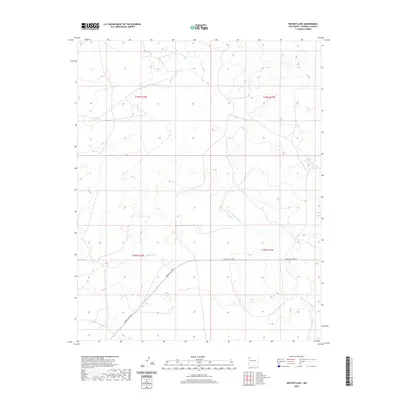
2020 Map of Becenti Lake
USGS Topo · Published 2020About this map
Becenti Lake serves as a central feature in this arid landscape of the Eastern Navajo Agency, where the drainage patterns of ephemeral watercourses define the terrain. The northern half of the map is dominated by the winding paths of Kim-me-ni-oli Wash and Seven Lakes Wash, which cut through the high desert floor. These natural features illustrate the traditional importance of seasonal water management in McKinley County. Human infrastructure is concentrated along the southern corridor, specifically following the path of Navajo Svc Rte 9. This route provides the primary transit artery across the townships of T18N and T19N, connecting the remote lake area to the broader regional network of the Navajo Nation.
Find a feature on this map
8 named features on this map. Tap any name to fly to it.
Don’t see what you’re looking for? This feature index may not catch every label — zoom into the map to look around manually.
Map Details
Editions of this 2020 Becenti Lake Map
This is the sole edition of this map. No revisions or reprints were ever made.
Other maps of this area

1883 · Mt. Taylor
USGS Topo · 1:250,000

1886 · Wingate
USGS Topo · 1:250,000

1886 · Mt. Taylor
USGS Topo · 1:250,000

1892 · Wingate
USGS Topo · 1:250,000

1892 · Mt. Taylor
USGS Topo · 1:250,000

1899 · Mt. Taylor
USGS Topo · 1:250,000

1954 · Gallup
USGS Topo · 1:250,000

1958 · Gallup
USGS Topo · 1:250,000

1958 · Albuquerque
USGS Topo · 1:250,000

1959 · Gallup
USGS Topo · 1:250,000