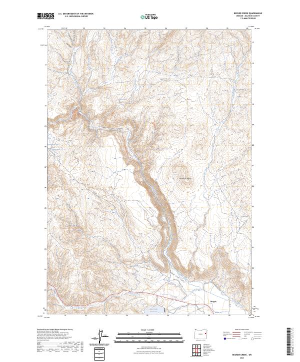
2023 Map of Becker Creek
USGS Topo · Published 2023About this map
Brogan serves as the primary settlement on this eastern Oregon landscape, situated at the edge of the Willow Creek Valley. The terrain is defined by a network of drainage systems and irrigation infrastructure, including the Cole Ditch, Low Line Ditch, and East Side Ditch, which redirect water through the arid basins. To the west, Edwards Butte rises as a prominent landmark above the surrounding creek beds and gulches. The importance of water management in this high-desert environment is evident in the presence of Pole Creek Reservoir and Davis Reservoir, alongside numerous family-named or local springs such as Three Boswell Spring and Worthington Spring. Historical transportation routes like Mormon Basin Cutoff Rd and Huntington Rd traverse the undulating hills, connecting this ranching and farming pocket of Malheur County to the broader region.
Find a feature on this map
36 named features on this map. Tap any name to fly to it.
Don’t see what you’re looking for? This feature index may not catch every label — zoom into the map to look around manually.
Map Details
Editions of this 2023 Becker Creek Map
This is the sole edition of this map. No revisions or reprints were ever made.
Other maps of this area

1950 · Jamieson
USGS Topo · 1:62,500

1951 · Huntington
USGS Topo · 1:62,500

1955 · Baker
USGS Topo · 1:250,000

1959 · Baker
USGS Topo · 1:250,000

1964 · Bridgeport
USGS Topo · 1:62,500

1964 · Brogan
USGS Topo · 1:62,500

1980 · Brogan
USGS Topo · 1:100,000
1988 · Birch Creek Meadow
USGS Topo · 1:24,000
1988 · Rye Valley
USGS Topo · 1:24,000
1988 · Jamieson
USGS Topo · 1:24,000