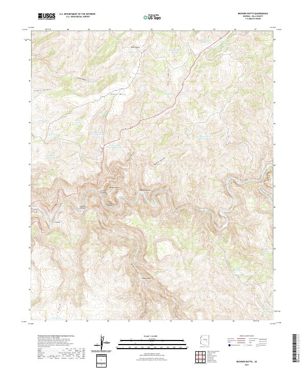
2021 Map of Beckers Butte
USGS Topo · Published 2021About this map
Beckers Butte overlooks the dramatic intersection of deep drainage systems where the Salt River Canyon meets the Salt River Valley. This rugged landscape in Gila County is defined by its complex network of seasonal water sources and livestock infrastructure, including family-named landmarks like the Ike Clyde Tank and Bohee Tank. The terrain rises from the riverbed to the expansive heights of Black Mesa, dissected by numerous canyons such as Well Canyon, Flying V Canyon, and Walnut Canyon. Water management is the primary human fingerprint on this territory, evidenced by a high density of named tanks and springs, including Flying V Spring, Coyote Spring, and Mud Spring. These features, along with the I S Hole and Frog Pond, suggest a history of ranching and resource management in a remote environment where every reliable water point was critical for survival and movement.
Find a feature on this map
50 named features on this map. Tap any name to fly to it.
Don’t see what you’re looking for? This feature index may not catch every label — zoom into the map to look around manually.
Map Details
Editions of this 2021 Beckers Butte Map
This is the sole edition of this map. No revisions or reprints were ever made.
Other maps of this area

1922 · Chrysotile
USGS Topo · 1:125,000

1946 · Blue House Mtn
USGS Topo · 1:62,500

1951 · Blue House Mtn
USGS Topo · 1:62,500

1954 · Mesa
USGS Topo · 1:250,000

1957 · Mesa
USGS Topo · 1:250,000

1958 · Mesa
USGS Topo · 1:250,000

1960 · Mesa
USGS Topo · 1:250,000

1964 · Mesa
USGS Topo · 1:250,000

1966 · Brushy Canyon
USGS Topo · 1:24,000

1966 · Popcorn Canyon
USGS Topo · 1:24,000