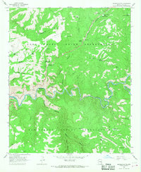
1966 Map of Beckers Butte
USGS Topo · Published 1968About this map
The Salt River carves a deep boundary between the Fort Apache Indian Reservation and the San Carlos Indian Reservation, defining the core of this mid-1960s landscape. High above the river, Black Mesa and Beckers Butte command the skyline, while a complex network of seasonal water sources like Flying V Spring and Mud Spring sustain the region. The map reveals the infrastructure of resource management in a dry environment, documented through numerous named stock tanks and the Mescal Pit Catchment Basin.
Find a feature on this map
44 named features on this map. Tap any name to fly to it.
Don’t see what you’re looking for? This feature index may not catch every label — zoom into the map to look around manually.
Map Details
Editions of this 1966 Beckers Butte Map
This is the sole edition of this map. No revisions or reprints were ever made.
Other maps of this area

1922 · Chrysotile
USGS Topo · 1:125,000

1946 · Blue House Mtn
USGS Topo · 1:62,500

1951 · Blue House Mtn
USGS Topo · 1:62,500

1954 · Mesa
USGS Topo · 1:250,000

1957 · Mesa
USGS Topo · 1:250,000

1958 · Mesa
USGS Topo · 1:250,000

1960 · Mesa
USGS Topo · 1:250,000

1964 · Mesa
USGS Topo · 1:250,000

1966 · Brushy Canyon
USGS Topo · 1:24,000

1966 · Popcorn Canyon
USGS Topo · 1:24,000