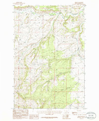
1986 Map of Becket
USGS Topo · Published 1986About this map
Becket and the surrounding drainage basins of Fergus County are defined by a complex network of seasonal and perennial watercourses that feed the South Fork Mc Donald Creek. The landscape transition is marked by prominent natural features such as Rose Canyon and the winding course of Atherton Creek. An interesting piece of industrial history is preserved here in the form of an Old Railroad Grade that skirts the northern hills, hinting at former transit corridors through this part of Montana.
Find a feature on this map
8 named features on this map. Tap any name to fly to it.
Don’t see what you’re looking for? This feature index may not catch every label — zoom into the map to look around manually.
Map Details
Editions of this 1986 Becket Map
This is the sole edition of this map. No revisions or reprints were ever made.
Other maps of this area

1889 · Big Snowy Mountain
USGS Topo · 1:250,000

1893 · Big Snowy Mountain
USGS Topo · 1:250,000

1941 · Judith Peak
USGS Topo · 1:62,500

1944 · Judith Peak
USGS Topo · 1:62,500

1954 · Roundup
USGS Topo · 1:250,000

1954 · Lewistown
USGS Topo · 1:250,000

1958 · Roundup
USGS Topo · 1:250,000

1959 · Lewistown
USGS Topo · 1:250,000

1970 · Forestgrove
USGS Topo · 1:24,000

1970 · South Bench
USGS Topo · 1:24,000