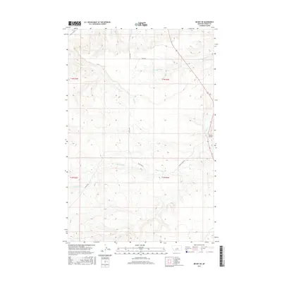
2017 Map of Becket NE
USGS Topo · Published 2017About this map
Tyler Cutoff and Forest Grove Rd anchor the transport network across this high prairie landscape in Fergus County. The topography is defined by the drainage basins of Beaver Ball Cr and Dry Fork, which carve shallow patterns across the northern and central sections of the quadrangle. To the southeast, the terrain shifts near Butler Coulee, where the elevation begins to drop toward the lower reaches of Elk Cr.
Find a feature on this map
14 named features on this map. Tap any name to fly to it.
Don’t see what you’re looking for? This feature index may not catch every label — zoom into the map to look around manually.
Map Details
Editions of this 2017 Becket NE Map
This is the sole edition of this map. No revisions or reprints were ever made.
Other maps of this area

1954 · Roundup
USGS Topo · 1:250,000

1954 · Lewistown
USGS Topo · 1:250,000

1958 · Roundup
USGS Topo · 1:250,000

1959 · Lewistown
USGS Topo · 1:250,000

1986 · Tyler
USGS Topo · 1:24,000

1986 · Briggs Coulee
USGS Topo · 1:24,000

1986 · Pike Creek Hills West
USGS Topo · 1:24,000
1986 · Grass Range
USGS Topo · 1:24,000
1986 · Fish Dam
USGS Topo · 1:24,000

1986 · Milk Springs
USGS Topo · 1:24,000