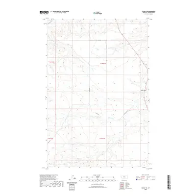
2020 Map of Becket NE
USGS Topo · Published 2020About this map
Butler Coulee and the drainage systems of Elk Cr characterize this portion of Fergus County, where a network of rural routes facilitates movement through the central Montana ranching landscape. The geography is defined by several forks and tributaries, including N Fork Elk Cr, Blacktail Cr, and Beaver-Ball Cr. These watercourses have shaped the local terrain, creating the distinct coulees and flats that define the region's agricultural and grazing potential.
Find a feature on this map
16 named features on this map. Tap any name to fly to it.
Don’t see what you’re looking for? This feature index may not catch every label — zoom into the map to look around manually.
Map Details
Editions of this 2020 Becket NE Map
This is the sole edition of this map. No revisions or reprints were ever made.
Other maps of this area

1954 · Roundup
USGS Topo · 1:250,000

1954 · Lewistown
USGS Topo · 1:250,000

1958 · Roundup
USGS Topo · 1:250,000

1959 · Lewistown
USGS Topo · 1:250,000

1986 · Tyler
USGS Topo · 1:24,000

1986 · Briggs Coulee
USGS Topo · 1:24,000

1986 · Pike Creek Hills West
USGS Topo · 1:24,000
1986 · Grass Range
USGS Topo · 1:24,000
1986 · Fish Dam
USGS Topo · 1:24,000

1986 · Milk Springs
USGS Topo · 1:24,000