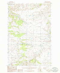
1986 Map of Becket NE
USGS Topo · Published 1986About this map
Pine Ridge dominates the western portion of this 1980s provisional survey, overlooking a network of drainages in central Montana's Fergus County. The landscape is defined by the headwaters and tributaries of several prominent creeks, including Beaver Creek, Ball Creek, and Elk Creek, which carve through the terrain. A notable Gravel Pit in the northern section indicates the localized industrial activity of the period, while the branching path of Dry Fork and North Fork Elk Creek suggests a complex watershed managed by the U.S. Geological Survey. This map captures the topography of the region just as modern digital mapping techniques were beginning to supplement traditional field-checked manuscript drawings, preserving the exact layout of drainage basins and ridges prior to more recent land-use changes.
Find a feature on this map
9 named features on this map. Tap any name to fly to it.
Don’t see what you’re looking for? This feature index may not catch every label — zoom into the map to look around manually.
Map Details
Editions of this 1986 Becket NE Map
This is the sole edition of this map. No revisions or reprints were ever made.
Other maps of this area

1954 · Roundup
USGS Topo · 1:250,000

1954 · Lewistown
USGS Topo · 1:250,000

1958 · Roundup
USGS Topo · 1:250,000

1959 · Lewistown
USGS Topo · 1:250,000

1986 · Tyler
USGS Topo · 1:24,000

1986 · Briggs Coulee
USGS Topo · 1:24,000

1986 · Pike Creek Hills West
USGS Topo · 1:24,000
1986 · Grass Range
USGS Topo · 1:24,000
1986 · Fish Dam
USGS Topo · 1:24,000

1986 · Milk Springs
USGS Topo · 1:24,000