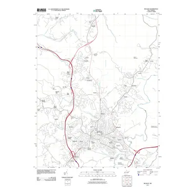
2011 Map of Beckley
USGS Topo · Published 2011About this map
Beckley serves as the bustling urban center of Raleigh County in this early 21st-century portrait, where the city's mining heritage is preserved at the Exhibition Mine. The map reveals a dense network of residential neighborhoods and industrial hubs, including Skelton, Mabscott, and MacArthur. Educational and civic life is anchored by Mountain State University and several dedicated postal facilities, while the landscape is punctuated by numerous memorial sites such as Wildwood Cemetery and Sunset Memorial Park. Beyond the city limits, the terrain transitions toward Batoff Mountain and the Piney River corridor. The layout of Beckley Junction and the presence of Old Mill Village reflect the historic intersection of industry and settlement that shaped this Appalachian community. Transportation is a defining feature, with the Raleigh County Memorial Airport providing regional access alongside major highway corridors.
Find a feature on this map
92 named features on this map. Tap any name to fly to it.
Don’t see what you’re looking for? This feature index may not catch every label — zoom into the map to look around manually.
Map Details
Editions of this 2011 Beckley Map
This is the sole edition of this map. No revisions or reprints were ever made.
Other maps of this area

1891 · Raleigh
USGS Topo · 1:125,000

1897 · Raleigh
USGS Topo · 1:125,000

1902 · Raleigh
USGS Topo · 1:125,000

1911 · Marshes
USGS Topo · 1:48,000

1911 · Flattop
USGS Topo · 1:48,000

1911 · Beckley
USGS Topo · 1:48,000

1912 · Mullens
USGS Topo · 1:62,500

1913 · Beckley
USGS Topo · 1:62,500

1914 · Eccles
USGS Topo · 1:62,500

1914 · Flattop
USGS Topo · 1:62,500