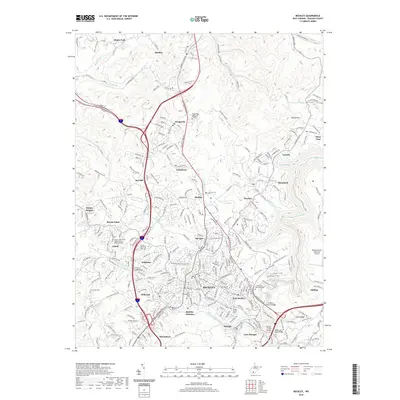
2019 Map of Beckley
USGS Topo · Published 2019About this map
Beckley serves as the focal point of this Raleigh County region, surrounded by a dense network of residential and industrial settlements. The city is flanked by established communities including Mabscott, East Beckley, and Skelton, while the landscape is heavily influenced by the presence of Whitestick Cr and Piney Creek. This modern survey illustrates the transition of the region's infrastructure, characterized by an extensive trail system including the Lewis McManus Memorial Honor Rail-Trail and various fitness paths near Sprague and Wickham. Genealogists will find a wealth of data through the numerous burial grounds such as Wildwood Cem, Greenwood Memorial Park, and the family-associated Mount Tabor Davis Addition Cem. The industrial and transportation legacy of the area is evident in the layout of Beckley Junction and the sprawling Raleigh County Memorial Airport to the east.
Find a feature on this map
61 named features on this map. Tap any name to fly to it.
Don’t see what you’re looking for? This feature index may not catch every label — zoom into the map to look around manually.
Map Details
Editions of this 2019 Beckley Map
This is the sole edition of this map. No revisions or reprints were ever made.
Other maps of this area

1891 · Raleigh
USGS Topo · 1:125,000

1897 · Raleigh
USGS Topo · 1:125,000

1902 · Raleigh
USGS Topo · 1:125,000

1911 · Marshes
USGS Topo · 1:48,000

1911 · Flattop
USGS Topo · 1:48,000

1911 · Beckley
USGS Topo · 1:48,000

1912 · Mullens
USGS Topo · 1:62,500

1913 · Beckley
USGS Topo · 1:62,500

1914 · Eccles
USGS Topo · 1:62,500

1914 · Flattop
USGS Topo · 1:62,500