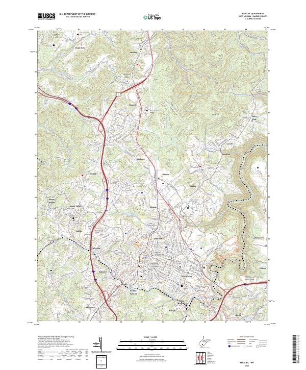
2023 Map of Beckley
USGS Topo · Published 2023About this map
Beckley serves as the central hub of this Raleigh County region, where the rugged topography is marked by a complex network of residential clusters and industrial corridors. The city is flanked by a constellation of smaller settlements including Mabscott, Skelton, and Sprague, reflecting the dense development patterns characteristic of West Virginia's coal and transit centers. The landscape is deeply etched by watercourses such as Piney Creek and Cranberry Creek, which dictate the winding paths of roads and the historical placement of the C & O RR.
Find a feature on this map
82 named features on this map. Tap any name to fly to it.
Don’t see what you’re looking for? This feature index may not catch every label — zoom into the map to look around manually.
Map Details
Editions of this 2023 Beckley Map
This is the sole edition of this map. No revisions or reprints were ever made.
Other maps of this area

1891 · Raleigh
USGS Topo · 1:125,000

1897 · Raleigh
USGS Topo · 1:125,000

1902 · Raleigh
USGS Topo · 1:125,000

1911 · Marshes
USGS Topo · 1:48,000

1911 · Flattop
USGS Topo · 1:48,000

1911 · Beckley
USGS Topo · 1:48,000

1912 · Mullens
USGS Topo · 1:62,500

1913 · Beckley
USGS Topo · 1:62,500

1914 · Eccles
USGS Topo · 1:62,500

1914 · Flattop
USGS Topo · 1:62,500