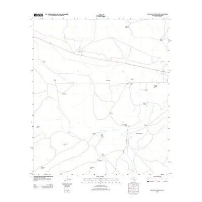
2012 Map of Beckwith Hills
USGS Topo · Published 2012About this map
Marathon anchors the northeastern corner of this West Texas landscape, serving as a gateway to the vast ranchlands and high-desert terrain of Brewster County. The map details a rugged environment where water management is central to the land's utility, marked by numerous named windmills and the vital Pena Colorado Spring. Historical sites like Old Fort Pena Colorada sit along the banks of Peña Colorado Cr, highlighting the area's strategic importance during the frontier era.
Find a feature on this map
36 named features on this map. Tap any name to fly to it.
Don’t see what you’re looking for? This feature index may not catch every label — zoom into the map to look around manually.
Map Details
Editions of this 2012 Beckwith Hills Map
This is the sole edition of this map. No revisions or reprints were ever made.
Other maps of this area

1920 · Monument Spring
USGS Topo · 1:62,500

1920 · Marathon
USGS Topo · 1:62,500

1921 · Monument Spring
USGS Topo · 1:62,500

1921 · Marathon
USGS Topo · 1:62,500

1923 · Hess Canyon
USGS Topo · 1:62,500

1923 · Altuda
USGS Topo · 1:62,500

1954 · Fort Stockton
USGS Topo · 1:250,000

1958 · Fort Stockton
USGS Topo · 1:250,000

1973 · Fort Stockton
USGS Topo · 1:250,000
1983 · Dugout Mountain
USGS Topo · 1:24,000