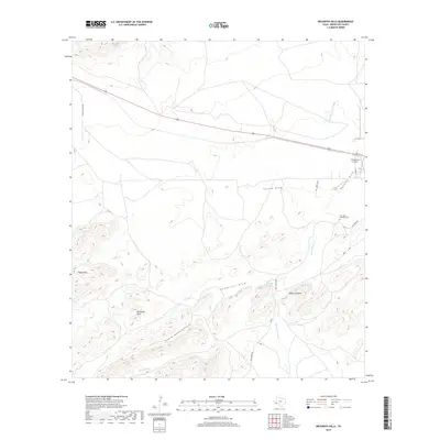
2019 Map of Beckwith Hills
USGS Topo · Published 2019About this map
The Beckwith Hills and Payne Hills define the varied terrain of this Brewster County landscape, where the Chihuahuan Desert’s intricate drainage patterns are carved into the earth. Central to the area’s water history is the Peña Colorado Spring, a vital water source that feeds into Peña Colorado Cr. This water system supported the establishment of the Fort Pena Colorado Cem, marking a site of early frontier presence in the Trans-Pecos. The map illustrates a network of ranch roads and dry washes such as Cartwright Draw and Little Road Canyon, which dictate the movement of people and livestock. Near the eastern edge, the Los Muertos Airport and local routes like Kate's Run show the modern connectivity laid over a land defined by ancient waterways like Alsate Cr and Monument Cr.
Find a feature on this map
22 named features on this map. Tap any name to fly to it.
Don’t see what you’re looking for? This feature index may not catch every label — zoom into the map to look around manually.
Map Details
Editions of this 2019 Beckwith Hills Map
This is the sole edition of this map. No revisions or reprints were ever made.
Other maps of this area

1920 · Monument Spring
USGS Topo · 1:62,500

1920 · Marathon
USGS Topo · 1:62,500

1921 · Monument Spring
USGS Topo · 1:62,500

1921 · Marathon
USGS Topo · 1:62,500

1923 · Hess Canyon
USGS Topo · 1:62,500

1923 · Altuda
USGS Topo · 1:62,500

1954 · Fort Stockton
USGS Topo · 1:250,000

1958 · Fort Stockton
USGS Topo · 1:250,000

1973 · Fort Stockton
USGS Topo · 1:250,000
1983 · Dugout Mountain
USGS Topo · 1:24,000