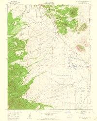
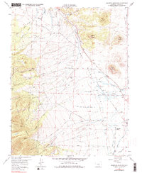
1958 Map of Beckwith Mountain
USGS Topo · Published 1960About this map
Wet Mountain Valley dominates the eastern half of this 1950s survey, illustrating a landscape defined by an intricate network of irrigation systems required for high-altitude ranching. Named canals such as the James Jarvis Swift Creek Ditch No 3, the Lower Smith Kettle Ditch, and the Freer-Beckwith Ditch reveal the intensive water management efforts that supported operations like the San Isabel Ranch. To the west, the terrain rises sharply into the San Isabel National Forest, where the Rainbow Trail skirts the base of the mountains near Buttermilk Draw and Greenleaf Creek.
Find a feature on this map
54 named features on this map. Tap any name to fly to it.
Don’t see what you’re looking for? This feature index may not catch every label — zoom into the map to look around manually.
Map Details
Editions of this 1958 Beckwith Mountain Map
7 editions found
Other maps of this area

1889 · Canon City
USGS Topo · 1:125,000

1892 · Canon City
USGS Topo · 1:125,000

1954 · Pueblo
USGS Topo · 1:250,000

1955 · Westcliffe
USGS Topo · 1:24,000

1957 · Pueblo
USGS Topo · 1:250,000

1957 · Aldrich Gulch
USGS Topo · 1:24,000

1958 · Pueblo
USGS Topo · 1:250,000

1958 · Beckwith Mountain
USGS Topo · 1:24,000

1959 · Electric Peak
USGS Topo · 1:62,500
1959 · Horn Peak
USGS Topo · 1:24,000