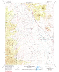
1958 Map of Beckwith Mountain
USGS Topo · Published 1990About this map
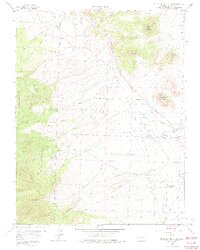
The Wet Mountain Valley in Custer County serves as a productive agricultural basin, defined by an intricate network of irrigation canals and early transport routes. Settlement is sparse, represented by places like San Isabel Ranch and The Pines, while the landscape is dominated by the massive heights of Beckwith Mountain and Beddows Mountain. The mapping reveals a carefully engineered water system, including the Upper Smith Kettle Ditch and the James Jarvis Swift Creek Ditch No 3, which diverted mountain runoff to the valley floor. Evidence of former industry remains visible in the Old Railroad Grade tracing the base of the peaks, while the San Isabel National Forest boundary marks the transition from open Prairie to the timbered slopes of the Sangre de Cristo range. Genealogists may find particular interest in the Ula Cem, a quiet record of early pioneer families in this high-altitude cattle country.
Find a feature on this map
53 named features on this map. Tap any name to fly to it.
Don’t see what you’re looking for? This feature index may not catch every label — zoom into the map to look around manually.
Map Details
Editions of this 1958 Beckwith Mountain Map
7 editions found
Other maps of this area

1889 · Canon City
USGS Topo · 1:125,000

1892 · Canon City
USGS Topo · 1:125,000

1954 · Pueblo
USGS Topo · 1:250,000

1955 · Westcliffe
USGS Topo · 1:24,000

1957 · Pueblo
USGS Topo · 1:250,000

1957 · Aldrich Gulch
USGS Topo · 1:24,000

1958 · Pueblo
USGS Topo · 1:250,000

1958 · Beckwith Mountain
USGS Topo · 1:24,000

1959 · Electric Peak
USGS Topo · 1:62,500
1959 · Horn Peak
USGS Topo · 1:24,000