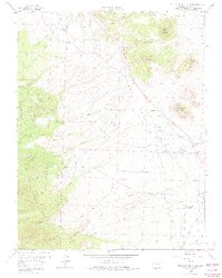
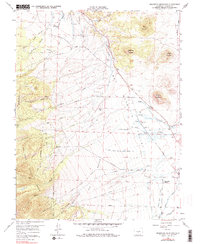
1958 Map of Beckwith Mountain
USGS Topo · Published 1975About this map
Wet Mountain Valley dominates this 1958 field-checked landscape, where the transition from high peaks to the Prairie Lulon floor reveals a complex history of water management and early transport. The map traces the Old Railroad Grade winding through the foothills, a relic of the region’s narrow-gauge era, alongside ranching settlements like The Pines and the San Isabel Ranch. Local genealogy is anchored by the The Pines Cem and Ula Cem, marking the early community center of Ula near the Hemenway Road. The reliance on gravity-fed irrigation is evident in the intricate network of the Lohrstrom Highline Ditch and the Freer-Beckwith and Kennicott Ditch, which channel water from the San Isabel National Forest to the valley's arid expanses. Natural landmarks such as Beckwith Mountain and Grouse Mountain overlook a landscape shaped by both cattle and extraction, evidenced by a Strip Mine and scattered gravel pits.
Find a feature on this map
53 named features on this map. Tap any name to fly to it.
Don’t see what you’re looking for? This feature index may not catch every label — zoom into the map to look around manually.
Map Details
Editions of this 1958 Beckwith Mountain Map
7 editions found
Other maps of this area

1889 · Canon City
USGS Topo · 1:125,000

1892 · Canon City
USGS Topo · 1:125,000

1954 · Pueblo
USGS Topo · 1:250,000

1955 · Westcliffe
USGS Topo · 1:24,000

1957 · Pueblo
USGS Topo · 1:250,000

1957 · Aldrich Gulch
USGS Topo · 1:24,000

1958 · Pueblo
USGS Topo · 1:250,000

1958 · Beckwith Mountain
USGS Topo · 1:24,000

1959 · Electric Peak
USGS Topo · 1:62,500
1959 · Horn Peak
USGS Topo · 1:24,000