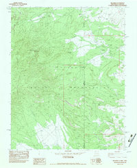
1982 Map of Beclabito
USGS Topo · Published 1983About this map
Beclabito serves as the primary settlement in this high-desert landscape of the Navajo Indian Reservation, situated where the high peaks of the Carrizo Mountains meet the plateau. The 1982 survey reveals a history of resource extraction, noting Syracuse Mine and the Copper Mine Ruins near the prominent geological feature of Beclabito Dome. The drainage patterns of Game Wash and Beclabito Wash define the local topography, while rare water sources like Twin Falls and Red Coal Spring provide vital landmarks in the arid terrain. Straddling the border of Arizona and New Mexico, the map documents the transition from the steep elevation of Black Rock Ridge to the alluvial plains, capturing the infrastructure of the early 1980s including a Gravel Pit and scattered prospect sites.
Find a feature on this map
18 named features on this map. Tap any name to fly to it.
Don’t see what you’re looking for? This feature index may not catch every label — zoom into the map to look around manually.
Map Details
Editions of this 1982 Beclabito Map
This is the sole edition of this map. No revisions or reprints were ever made.
Other maps of this area

1889 · Chaco
USGS Topo · 1:250,000

1892 · Chaco
USGS Topo · 1:250,000

1892 · Canyon De Chelly
USGS Topo · 1:250,000

1934 · Ship Rock
USGS Topo · 1:62,500

1934 · Rattlesnake
USGS Topo · 1:62,500

1937 · Ship Rock
USGS Topo · 1:62,500

1937 · Rattlesnake
USGS Topo · 1:62,500

1953 · Redrock Valley NE
USGS Topo · 1:24,000

1953 · Pastora Peak SW
USGS Topo · 1:24,000

1953 · Pastora Peak NW
USGS Topo · 1:24,000
Featured Places
- Shiprock Agency
- Beclabito, Shiprock Agency
- Beclabito, Shiprock Agency
- Twin Falls, Shiprock Agency
- San Juan County, NM