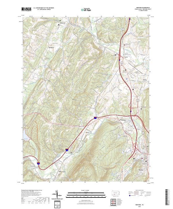
2023 Map of Bedford
USGS Topo · Published 2023About this map
Bedford serves as a focal point for this section of Bedford County, where the Raystown Branch Juniata River and Dunning Creek converge. The landscape is defined by the sharp rise of Wills Mountain and Kinton Knob, which separate the river valley from the western uplands. This area preserves a high density of genealogical sites, including the Old Presbyterian Graveyard and several denominational burial grounds such as the German Reformed and Lutheran Church Cem and Saint Thomas the Apostle Catholic Cem. To the west, the settlement of Manns Choice sits near the Buffalo Run confluence, while the Pigeon Hills dominate the central terrain. Infrastructure like the Bedford County Airport and the network of roads including Old RTE 30 and Glade Pike follow the historical path of travel through the gaps in the ridges, illustrating how the physical geography has long dictated the movement of people through the region.
Find a feature on this map
74 named features on this map. Tap any name to fly to it.
Don’t see what you’re looking for? This feature index may not catch every label — zoom into the map to look around manually.
Map Details
Editions of this 2023 Bedford Map
This is the sole edition of this map. No revisions or reprints were ever made.
Other maps of this area

1900 · Everett
USGS Topo · 1:62,500

1902 · Everett
USGS Topo · 1:62,500

1908 · Bedford
USGS Topo · 1:62,500

1910 · Bedford
USGS Topo · 1:62,500

1927 · Clearville
USGS Topo · 1:48,000

1927 · Hyndman
USGS Topo · 1:62,500

1931 · Clearville
USGS Topo · 1:62,500

1931 · Hyndman
USGS Topo · 1:62,500

1944 · Hyndman
USGS Topo · 1:62,500

1944 · Clearville
USGS Topo · 1:62,500