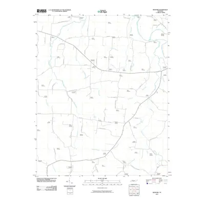
2010 Map of Bedford
USGS Topo · Published 2010About this map
Duck River and its numerous tributaries, including Sinking Creek and Sugar Creek, define the topography of this section of Bedford County. The landscape is marked by a dense concentration of family and community burial grounds, such as Stephenson Cemetery, Whitesell-Wilhoite Cemetery, and the Barrett-Carlisle Cemetery, suggesting a deeply rooted rural population. Transportation is facilitated by a network of established routes like Fishing Ford Pike and Bethlehem Church Rd, which link the various hollers and ridge communities. Significant local landmarks like Temple Ford indicate historic crossing points along the river, while geographical features like Adams Hollow and Renegar Hollow provide insight into the local terrain. The distribution of sites like Moore Chapel Cemetery and New Bethel Cemetery further illustrates the social and spiritual hubs that have anchored this Tennessee community through the early 21st century.
Find a feature on this map
103 named features on this map. Tap any name to fly to it.
Don’t see what you’re looking for? This feature index may not catch every label — zoom into the map to look around manually.
Map Details
Editions of this 2010 Bedford Map
This is the sole edition of this map. No revisions or reprints were ever made.
Other maps of this area

1936 · Booneville
USGS Topo · 1:24,000

1936 · Farmington
USGS Topo · 1:24,000

1936 · Shelbyville
USGS Topo · 1:24,000

1936 · Belfast
USGS Topo · 1:24,000

1936 · Deason
USGS Topo · 1:24,000

1936 · Belleville
USGS Topo · 1:24,000

1936 · Petersburg
USGS Topo · 1:24,000

1936 · Unionville
USGS Topo · 1:24,000

1936 · Bedford
USGS Topo · 1:24,000

1944 · Shelbyville
USGS Topo · 1:100,000