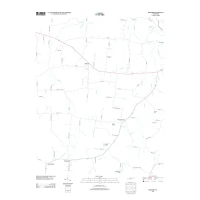
2013 Map of Bedford
USGS Topo · Published 2013About this map
The Duck River winds through the northeast corner of this central Tennessee landscape, anchored by the settlement of Bedford and the crossroads at Pleasant Grove. The terrain is defined by a series of branching drainages and hollows, including Adams Hollow and Bluestocking Hollow, where small creeks like Sugar Cr and Powell Cr have carved the agricultural land. Local infrastructure is evidenced by the Pleasant Grove Airpark and historical crossing points such as Temple Ford and Sims Bridge. Toward the southern edge, the map identifies the adjacent communities of Richmond and Branchville, revealing a pattern of rural development where family farms and ranches, including Chanthaphone Farm and Rising Star Ranch, are situated along a network of established local roads. This survey illustrates the persistence of small-scale agriculture and regional aviation in the Bedford County countryside during the early 21st century.
Find a feature on this map
76 named features on this map. Tap any name to fly to it.
Don’t see what you’re looking for? This feature index may not catch every label — zoom into the map to look around manually.
Map Details
Editions of this 2013 Bedford Map
This is the sole edition of this map. No revisions or reprints were ever made.
Other maps of this area

1936 · Booneville
USGS Topo · 1:24,000

1936 · Farmington
USGS Topo · 1:24,000

1936 · Shelbyville
USGS Topo · 1:24,000

1936 · Belfast
USGS Topo · 1:24,000

1936 · Deason
USGS Topo · 1:24,000

1936 · Belleville
USGS Topo · 1:24,000

1936 · Petersburg
USGS Topo · 1:24,000

1936 · Unionville
USGS Topo · 1:24,000

1936 · Bedford
USGS Topo · 1:24,000

1944 · Shelbyville
USGS Topo · 1:100,000