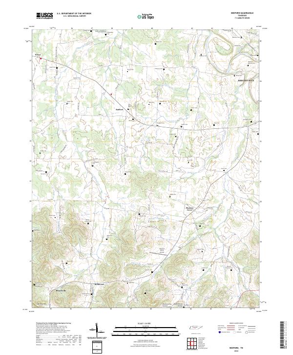
2022 Map of Bedford
USGS Topo · Published 2022About this map
Sinking Creek and the Duck River anchor this rural landscape in central Tennessee, where small settlements like Bedford, Pleasant Grove, and Richmond are connected by a dense network of family-named roads. The map reveals a remarkable concentration of family burial grounds and community cemeteries, such as New Bethel Cem, Tallaferro Cem, and Porter-Cortner Cem, which speak to the deep genealogical roots of the region. The terrain shifts from the flat stretches near Pleasant Grove Airpark to the more dissected topography of Adams Hollow and Bluestocking Hollow. This modern survey documents how historical land divisions and small-scale creek systems like Little Sinking Cr and Sugar Creek continue to shape the movement and settlement patterns of the county today, long after the earliest homesteads were established.
Find a feature on this map
119 named features on this map. Tap any name to fly to it.
Don’t see what you’re looking for? This feature index may not catch every label — zoom into the map to look around manually.
Map Details
Editions of this 2022 Bedford Map
This is the sole edition of this map. No revisions or reprints were ever made.
Other maps of this area

1936 · Booneville
USGS Topo · 1:24,000

1936 · Farmington
USGS Topo · 1:24,000

1936 · Shelbyville
USGS Topo · 1:24,000

1936 · Belfast
USGS Topo · 1:24,000

1936 · Deason
USGS Topo · 1:24,000

1936 · Belleville
USGS Topo · 1:24,000

1936 · Petersburg
USGS Topo · 1:24,000

1936 · Unionville
USGS Topo · 1:24,000

1936 · Bedford
USGS Topo · 1:24,000

1944 · Shelbyville
USGS Topo · 1:100,000