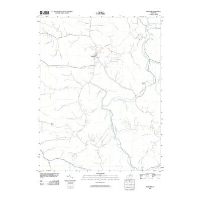
2010 Map of Bedford
USGS Topo · Published 2010About this map
Bedford serves as the central hub for this portion of Trimble County, situated at the junction of several primary regional roads. The landscape is defined by the winding course of the Little Kentucky River, which moves through the eastern half of the area, joined by numerous tributaries including Town Branch and Hardy Creek. This drainage network has carved a complex series of ridges and hollows, such as Morton Ridge and Science Hollow, which dictate the local topography and the placement of rural residences.
Find a feature on this map
54 named features on this map. Tap any name to fly to it.
Don’t see what you’re looking for? This feature index may not catch every label — zoom into the map to look around manually.
Map Details
Editions of this 2010 Bedford Map
This is the sole edition of this map. No revisions or reprints were ever made.
Other maps of this area

1928 · New Castle
USGS Topo · 1:48,000

1932 · New Castle
USGS Topo · 1:62,500

1932 · La Grange
USGS Topo · 1:62,500

1939 · Bethlehem
USGS Topo · 1:24,000

1939 · Madison West
USGS Topo · 1:24,000

1943 · Brooksburg
USGS Topo · 1:24,000

1948 · Bethlehem
USGS Topo · 1:24,000

1948 · Madison West
USGS Topo · 1:24,000

1952 · Campbellsburg
USGS Topo · 1:24,000

1953 · Madison West
USGS Topo · 1:24,000