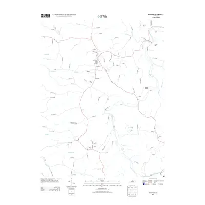
2013 Map of Bedford
USGS Topo · Published 2013About this map
Bedford serves as the central hub of this northern Kentucky landscape, where several major routes converge amidst a network of winding watercourses and distinct ridges. The town's layout is defined by thoroughfares like Pendleton Ave and Fairground Rd, while the surrounding rural geography is shaped by the Little Kentucky River and its numerous tributaries. These waterways, including Hardy Cr, Pattons Cr, and Barebone Cr, carve through the terrain to create locally recognized landmarks such as Bunker Hill and Science Hollow. Genealogists may find interest in the Burrows Cem located south of the main settlement. The map illustrates a mature rural infrastructure where residential lanes like Mullikin Ln and Lehue Rd branch out from the primary corridors, following the natural contours of Morton Ridge and the various creek valleys.
Find a feature on this map
104 named features on this map. Tap any name to fly to it.
Don’t see what you’re looking for? This feature index may not catch every label — zoom into the map to look around manually.
Map Details
Editions of this 2013 Bedford Map
This is the sole edition of this map. No revisions or reprints were ever made.
Other maps of this area

1928 · New Castle
USGS Topo · 1:48,000

1932 · New Castle
USGS Topo · 1:62,500

1932 · La Grange
USGS Topo · 1:62,500

1939 · Bethlehem
USGS Topo · 1:24,000

1939 · Madison West
USGS Topo · 1:24,000

1943 · Brooksburg
USGS Topo · 1:24,000

1948 · Bethlehem
USGS Topo · 1:24,000

1948 · Madison West
USGS Topo · 1:24,000

1952 · Campbellsburg
USGS Topo · 1:24,000

1953 · Madison West
USGS Topo · 1:24,000