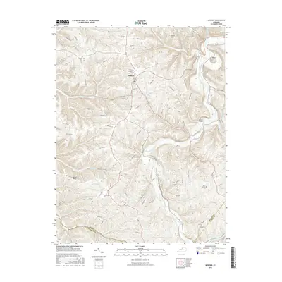
2016 Map of Bedford
USGS Topo · Published 2016About this map
Bedford serves as the central hub of this northern Kentucky landscape, where the town grid gives way to a complex network of ridges and hollows carved by the Little Kentucky River. The terrain is defined by prominent elevations such as Fishers Ridge and Bunker Hill, while deep incisions like Science Hollow demonstrate the local drainage patterns into Daugherty Creek and the White Sulphur Fork. This 2016 survey captures a rural environment where land use is dictated by the winding path of the river, which snakes through the center of the quadrangle. For those studying local history, the map provides precise locations for family-named sites including the Staten-Garriott Cem and Foree Cem Number 2, alongside numerous other small burial grounds scattered among the farms. The southern reaches of the map document the county lines where Trimble meets Oldham and Henry counties.
Find a feature on this map
85 named features on this map. Tap any name to fly to it.
Don’t see what you’re looking for? This feature index may not catch every label — zoom into the map to look around manually.
Map Details
Editions of this 2016 Bedford Map
This is the sole edition of this map. No revisions or reprints were ever made.
Other maps of this area

1928 · New Castle
USGS Topo · 1:48,000

1932 · New Castle
USGS Topo · 1:62,500

1932 · La Grange
USGS Topo · 1:62,500

1939 · Bethlehem
USGS Topo · 1:24,000

1939 · Madison West
USGS Topo · 1:24,000

1943 · Brooksburg
USGS Topo · 1:24,000

1948 · Bethlehem
USGS Topo · 1:24,000

1948 · Madison West
USGS Topo · 1:24,000

1952 · Campbellsburg
USGS Topo · 1:24,000

1953 · Madison West
USGS Topo · 1:24,000