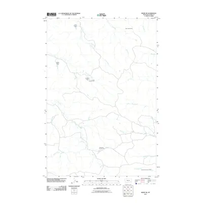
2011 Map of Beebe SW
USGS Topo · Published 2011About this map
Jack Creek Divide defines the upper reaches of this Custer County landscape, where an intricate network of drainage basins reveals a history of water management and livestock ranching. Numerous small-scale reservoirs and dams, named for local figures or operations, punctuate the terrain. Notable examples include the A J Barta Number 1 Dam, Christensen Number 6 Dam, and Failing Number 4 Dam. These features, along with the Failings Number 2 Dam, suggest a highly managed prairie environment where every creek and fork is utilized. The map traces the winding paths of Nelson Creek, Prat Creek, and East Fork Ash Creek as they navigate the ridges and coulees. This 2011 survey captures the quiet, utilitarian infrastructure of Montana's high plains, highlighting the significance of water rights and family-named landmarks like Chinnick Creek and Maggie Creek in this sparse rural area.
Find a feature on this map
20 named features on this map. Tap any name to fly to it.
Don’t see what you’re looking for? This feature index may not catch every label — zoom into the map to look around manually.
Map Details
Editions of this 2011 Beebe SW Map
This is the sole edition of this map. No revisions or reprints were ever made.
Other maps of this area

1953 · Miles City
USGS Topo · 1:250,000

1954 · Ekalaka
USGS Topo · 1:250,000

1956 · Ekalaka
USGS Topo · 1:250,000

1957 · Miles City
USGS Topo · 1:250,000

1958 · Miles City
USGS Topo · 1:250,000

1958 · Ekalaka
USGS Topo · 1:250,000

1965 · Ekalaka
USGS Topo · 1:250,000

1969 · Horse Creek
USGS Topo · 1:24,000

1969 · Circle L Creek
USGS Topo · 1:24,000

1969 · First Creek
USGS Topo · 1:24,000