
1969 Map of First Creek
USGS Topo · Published 1973About this map
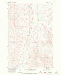
Pumpkin Creek meanders through this portion of Custer County, serving as the primary hydrological spine for a landscape defined by seasonal drainages and cattle country. Photogrammetric methods from 1968 reveal a sparsely settled territory where water management is paramount, evidenced by the numerous wells scattered across the township lines. The human footprint is centered on isolated landmarks such as the Monta Sch, a vital touchstone for local genealogy and the history of rural education in Montana's high plains.
Find a feature on this map
17 named features on this map. Tap any name to fly to it.
Don’t see what you’re looking for? This feature index may not catch every label — zoom into the map to look around manually.
Map Details
Editions of this 1969 First Creek Map
This is the sole edition of this map. No revisions or reprints were ever made.
Other maps of this area

1953 · Miles City
USGS Topo · 1:250,000

1957 · Miles City
USGS Topo · 1:250,000

1958 · Miles City
USGS Topo · 1:250,000

1969 · Horse Creek
USGS Topo · 1:24,000

1969 · Haines Springs
USGS Topo · 1:24,000

1969 · Loaf of Bread Butte
USGS Topo · 1:24,000

1969 · Beebe SW
USGS Topo · 1:24,000

1969 · Miles City Creek
USGS Topo · 1:24,000
1969 · Beebe
USGS Topo · 1:24,000
1969 · Whitney Creek
USGS Topo · 1:24,000