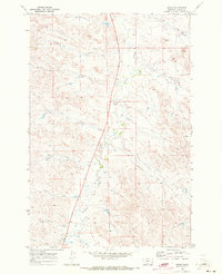
1969 Map of Beebe
USGS Topo · Published 1973About this map
Beebe (Site) occupies a central position in this remote section of Custer County, marked here as a point of interest along the drainage of Pumpkin Creek. The landscape is defined by an intricate network of ephemeral watercourses including La Grange Creek, Fire Creek, and Rough Creek that carve into the high plains. This late-1960s survey illustrates a ranching-driven economy where life followed the contours of the land and the reliable water of several wells. Transport through the area relied on the Powderville Road, while small Landing Strips provided vital aerial access to these isolated sections. The map preserves a moment when small outposts like Beebe remained significant enough for federal cartographic recording, even as the rural population began to consolidate or shift. Local family names or regional descriptors appear in features like Maggie Creek and Chinnick Creek, providing valuable leads for genealogical research into this corner of Montana.
Find a feature on this map
18 named features on this map. Tap any name to fly to it.
Don’t see what you’re looking for? This feature index may not catch every label — zoom into the map to look around manually.
Map Details
Editions of this 1969 Beebe Map
This is the sole edition of this map. No revisions or reprints were ever made.
Other maps of this area

1953 · Miles City
USGS Topo · 1:250,000

1954 · Ekalaka
USGS Topo · 1:250,000

1956 · Ekalaka
USGS Topo · 1:250,000

1957 · Miles City
USGS Topo · 1:250,000

1958 · Miles City
USGS Topo · 1:250,000

1958 · Ekalaka
USGS Topo · 1:250,000

1965 · Ekalaka
USGS Topo · 1:250,000

1969 · Horse Creek
USGS Topo · 1:24,000

1969 · First Creek
USGS Topo · 1:24,000

1969 · Loaf of Bread Butte
USGS Topo · 1:24,000