
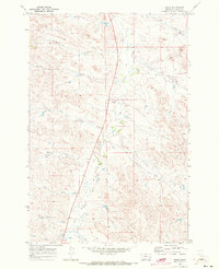
1969 Map of Loaf of Bread Butte
USGS Topo · Published 1973About this map
Loaf of Bread Butte stands as the central landmark in this corner of Custer County, overlooking a network of seasonal drainages that defined the ranching landscape of the late 1960s. The terrain is deeply incised by Fivemile Creek and Timothy Creek, showing a pattern of erosion characteristic of the Montana plains. Unlike many areas with developed townships, this landscape is defined by its watercourses and topographic features rather than settlements. Evidence of resource exploration appears in the north, where a Drill Hole is marked, suggesting the search for minerals or groundwater. The intricate branching of the North Fork and South Fork into smaller coulees like Johnson Creek and First Creek illustrates the complex drainage system that dictated movement and grazing across this section of the Great Plains.
Find a feature on this map
9 named features on this map. Tap any name to fly to it.
Don’t see what you’re looking for? This feature index may not catch every label — zoom into the map to look around manually.
Map Details
Editions of this 1969 Loaf of Bread Butte Map
This is the sole edition of this map. No revisions or reprints were ever made.
Other maps of this area

1953 · Miles City
USGS Topo · 1:250,000

1957 · Miles City
USGS Topo · 1:250,000

1958 · Miles City
USGS Topo · 1:250,000

1969 · Haines Springs
USGS Topo · 1:24,000

1969 · Mizpah
USGS Topo · 1:24,000

1969 · First Creek
USGS Topo · 1:24,000

1969 · Forty Creek
USGS Topo · 1:24,000

1969 · Locate SE
USGS Topo · 1:24,000

1969 · Miles City Creek
USGS Topo · 1:24,000
1969 · Beebe
USGS Topo · 1:24,000