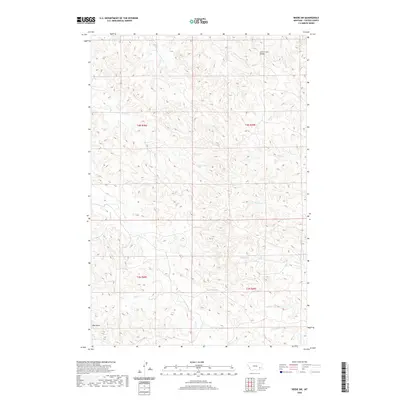
2020 Map of Beebe SW
USGS Topo · Published 2020About this map
Jack Creek Divide serves as a prominent geographic spine across this portion of Custer County, separating the various drainages that define the local topography. This 2020 USGS survey illustrates a landscape dominated by its water network, where numerous seasonal and perennial streams like Ash Creek and Cabin Creek carve through the terrain. The distribution of these waterways suggests a ranching landscape where access to water is paramount, with Nelson Creek and Pratt Creek extending into the northern reaches. In the southwest, Red Butte stands as a notable landmark near Winter Creek, while the eastern sections are marked by more intricate drainage systems including Maggie Creek and Chinnick Creek. The map provides a clear look at the township and range boundaries that organize this section of the Montana prairie.
Find a feature on this map
20 named features on this map. Tap any name to fly to it.
Don’t see what you’re looking for? This feature index may not catch every label — zoom into the map to look around manually.
Map Details
Editions of this 2020 Beebe SW Map
This is the sole edition of this map. No revisions or reprints were ever made.
Other maps of this area

1953 · Miles City
USGS Topo · 1:250,000

1954 · Ekalaka
USGS Topo · 1:250,000

1956 · Ekalaka
USGS Topo · 1:250,000

1957 · Miles City
USGS Topo · 1:250,000

1958 · Miles City
USGS Topo · 1:250,000

1958 · Ekalaka
USGS Topo · 1:250,000

1965 · Ekalaka
USGS Topo · 1:250,000

1969 · Horse Creek
USGS Topo · 1:24,000

1969 · Circle L Creek
USGS Topo · 1:24,000

1969 · First Creek
USGS Topo · 1:24,000