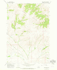
1965 Map of Beech Creek
USGS Topo · Published 1968About this map
The Blacktail Mountains dominate this high-country landscape, where narrow canyons and seasonal drainages define the remote terrain of Beaverhead County. This 1965 field-checked survey reveals a network of watercourses branching through the ridges, including the distinct West Fork Beech Creek and East Fork Beech Creek. The nomenclature of the area reflects a history of ranching and livestock movement, seen in names like Cattle Creek, Bull Heifer Creek, and Long Creek.
Find a feature on this map
18 named features on this map. Tap any name to fly to it.
Don’t see what you’re looking for? This feature index may not catch every label — zoom into the map to look around manually.
Map Details
Editions of this 1965 Beech Creek Map
This is the sole edition of this map. No revisions or reprints were ever made.
Other maps of this area

1893 · Dillon
USGS Topo · 1:250,000

1952 · Gallagher Mountain
USGS Topo · 1:24,000

1955 · Dubois
USGS Topo · 1:250,000

1955 · Dillon
USGS Topo · 1:250,000

1957 · Dillon
USGS Topo · 1:250,000

1958 · Dubois
USGS Topo · 1:250,000

1958 · Dillon
USGS Topo · 1:250,000

1961 · Ashbough Canyon
USGS Topo · 1:24,000

1961 · Elk Gulch
USGS Topo · 1:24,000

1962 · Dillon
USGS Topo · 1:250,000