
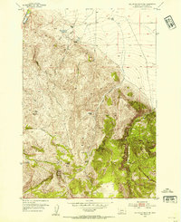
1952 Map of Gallagher Mountain
USGS Topo · Published 1954About this map
Flynn Brothers Ranch and several other family-owned livestock operations define this high-altitude landscape in the early 1950s. The map reveals a remote ranching economy dependent on reliable water sources like the Lovells Lake (Warm Spring Area) and the headwaters of Gallagher Creek. The terrain is marked by prominent peaks, including Gallagher Mountain and Jim Brown Mountain, which separate deep drainages such as Long Gulch and Little Basin Canyon.
Find a feature on this map
32 named features on this map. Tap any name to fly to it.
Don’t see what you’re looking for? This feature index may not catch every label — zoom into the map to look around manually.
Map Details
Editions of this 1952 Gallagher Mountain Map
2 editions found
Other maps of this area

1893 · Dillon
USGS Topo · 1:250,000

1952 · Burns Mountain
USGS Topo · 1:24,000

1952 · Dalys
USGS Topo · 1:24,000

1955 · Dubois
USGS Topo · 1:250,000

1955 · Dillon
USGS Topo · 1:250,000

1957 · Dillon
USGS Topo · 1:250,000

1958 · Dubois
USGS Topo · 1:250,000

1958 · Dillon
USGS Topo · 1:250,000

1961 · Ashbough Canyon
USGS Topo · 1:24,000

1962 · Dillon
USGS Topo · 1:250,000