
1952 Map of Dalys
USGS Topo · Published 1954About this map
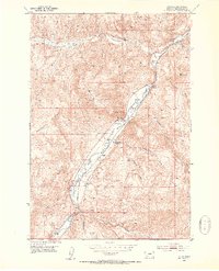
Beaverhead River carving through the heart of this valley defines the mid-century landscape of Beaverhead County. The corridor serves as a vital transportation and ranching artery, where the Union Pacific line runs parallel to the water. Significant family holdings like Mooney Ranch, Ney Ranch, and McMenomey Ranch dominate the valley floor, illustrating the agricultural foundations of the region in the early 1950s.
Find a feature on this map
27 named features on this map. Tap any name to fly to it.
Don’t see what you’re looking for? This feature index may not catch every label — zoom into the map to look around manually.
Map Details
Editions of this 1952 Dalys Map
4 editions found
Other maps of this area

1893 · Dillon
USGS Topo · 1:250,000

1952 · Bannack
USGS Topo · 1:24,000

1952 · Burns Mountain
USGS Topo · 1:24,000

1952 · Eli Spring
USGS Topo · 1:24,000

1952 · Gallagher Mountain
USGS Topo · 1:24,000

1955 · Dubois
USGS Topo · 1:250,000

1955 · Dillon
USGS Topo · 1:250,000

1957 · Dillon
USGS Topo · 1:250,000

1958 · Dubois
USGS Topo · 1:250,000

1958 · Dillon
USGS Topo · 1:250,000