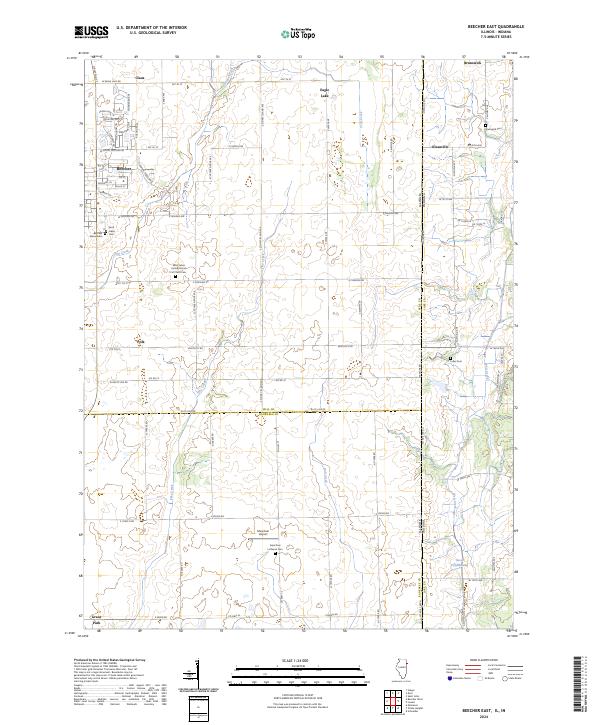
2024 Map of Beecher East
USGS Topo · Published 2024About this map
Beecher and its surrounding rural townships sit at the intersection of agricultural tradition and modern infrastructure along the Illinois-Indiana state line. The landscape is defined by the headwaters of Trim Creek and Pike Creek, which drain the level farm country between the historic settlements of Polk and Claus. This modern survey reveals a dense network of country cemeteries and parish sites that anchor the local history, including the Saint Johns United Church of Christ Cem and the Saint Paul Lutheran Cem. To the east, the boundary between Will County, Illinois, and Lake County, Indiana, passes through the crossroads of Klaasville, while the northern reaches include the community of Brunswick and its associated Brunswick Cem. The area maintains its rural character with specialized landmarks like the Mussman Airport and the Beecher Mausoleum, even as contemporary roads like S Stoney Island Ave and Stateline Rd connect the scattered homesteads.
Find a feature on this map
87 named features on this map. Tap any name to fly to it.
Don’t see what you’re looking for? This feature index may not catch every label — zoom into the map to look around manually.
Map Details
Editions of this 2024 Beecher East Map
This is the sole edition of this map. No revisions or reprints were ever made.
Other maps of this area

1922 · Momence
USGS Topo · 1:62,500

1924 · Momence
USGS Topo · 1:62,500

1929 · Dyer
USGS Topo · 1:24,000

1930 · Dyer
USGS Topo · 1:24,000

1930 · Steger
USGS Topo · 1:24,000

1949 · Crete
USGS Topo · 1:62,500

1953 · St. John
USGS Topo · 1:24,000
1953 · Steger
USGS Topo · 1:24,000

1953 · Beecher West
USGS Topo · 1:24,000

1953 · Beecher East
USGS Topo · 1:24,000