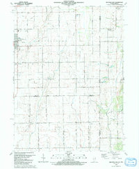
1990 Map of Beecher East
USGS Topo · Published 1991About this map
The town of Beecher and the surrounding rural landscapes of eastern Illinois and western Indiana are meticulously detailed in this late-century topographic study. The area is defined by a transition from the structured street grids of settlements to the broad reaches of Washington and Yellowhead townships. Significant local landmarks include St Lukes Cem and St John Ch, alongside recreational spaces like the Shady Lawn Golf Course. The map captures the subtle hydrology of the region, featuring Eagle Lake and the winding paths of Trim Creek and Pike Creek.
Find a feature on this map
45 named features on this map. Tap any name to fly to it.
Don’t see what you’re looking for? This feature index may not catch every label — zoom into the map to look around manually.
Map Details
Editions of this 1990 Beecher East Map
This is the sole edition of this map. No revisions or reprints were ever made.
Other maps of this area

1922 · Momence
USGS Topo · 1:62,500

1924 · Momence
USGS Topo · 1:62,500

1929 · Dyer
USGS Topo · 1:24,000

1930 · Dyer
USGS Topo · 1:24,000

1930 · Steger
USGS Topo · 1:24,000

1949 · Crete
USGS Topo · 1:62,500

1953 · St. John
USGS Topo · 1:24,000
1953 · Steger
USGS Topo · 1:24,000

1953 · Beecher West
USGS Topo · 1:24,000

1953 · Beecher East
USGS Topo · 1:24,000