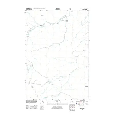
2011 Map of Beehive
USGS Topo · Published 2011About this map
Beehive and Dean anchor this Stillwater County landscape where the river valley meets the northern foothills of the Beartooth Range. The map details a complex network of canyons and creeks, including Midnight Canyon and the winding Stillwater River, which is flanked by the distinctive Beehive Rock. Settlement patterns here follow the water, with ranches and dwellings clustered along Stillwater River RD and Nye RD. Human modification of the terrain for agriculture is evidenced by the Lewis-Hudson-Fowler Ditch cutting across the southern plains near Fishtail Butte. The northern portion of the quadrangle is largely defined by vertical relief, from Dark Canyon to the southern high points of Nellies Twin Buttes, while recreation is marked by the Castle Rock Campground and the Dale Creek Bridge crossing.
Find a feature on this map
35 named features on this map. Tap any name to fly to it.
Don’t see what you’re looking for? This feature index may not catch every label — zoom into the map to look around manually.
Map Details
Editions of this 2011 Beehive Map
This is the sole edition of this map. No revisions or reprints were ever made.
Other maps of this area

1891 · Big Timber
USGS Topo · 1:125,000

1893 · Big Timber
USGS Topo · 1:125,000

1898 · Granite Mountain District
USGS Topo · 1:125,000

1932 · Nye No 1
USGS Topo · 1:48,000

1932 · Nye No 2
USGS Topo · 1:48,000

1939 · Mt Wood
USGS Topo · 1:62,500

1941 · Mt. Wood
USGS Topo · 1:62,500

1954 · Billings
USGS Topo · 1:250,000

1955 · Sandborn Creek
USGS Topo · 1:24,000
1955 · Wildcat Draw
USGS Topo · 1:24,000