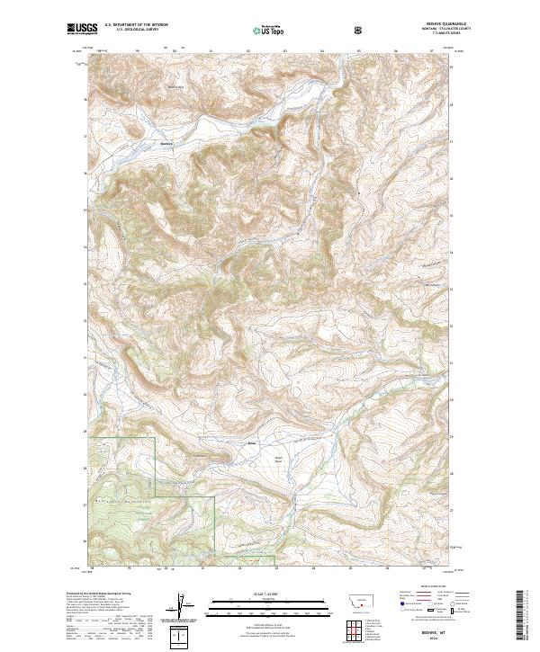
2024 Map of Beehive
USGS Topo · Published 2024About this map
Beehive and Dean anchor this Stillwater County landscape where the Stillwater River cuts through a canyon-defined terrain at the northern edge of the Beartooth Mountains. The map reveals a complex system of drainage and water management, including the Lewis Hudson-Fowler Ditch in the Dean Basin and the high-elevation waters of Island Lake and Heart Lake. Within the Custer National Forest, the topography rises sharply toward prominent landmarks like Beehive Rock and Fishtail Butte. The transition from river valley to mountain front is marked by a network of forest development roads and trails, such as Benbow Rd and Trinity Trl, which provide access to this remote corner of Montana. This modern survey is a primary reference for understanding the enduring settlement patterns and water rights of the Fishtail Creek drainage.
Find a feature on this map
86 named features on this map. Tap any name to fly to it.
Don’t see what you’re looking for? This feature index may not catch every label — zoom into the map to look around manually.
Map Details
Editions of this 2024 Beehive Map
This is the sole edition of this map. No revisions or reprints were ever made.
Other maps of this area

1891 · Big Timber
USGS Topo · 1:125,000

1893 · Big Timber
USGS Topo · 1:125,000

1898 · Granite Mountain District
USGS Topo · 1:125,000

1932 · Nye No 1
USGS Topo · 1:48,000

1932 · Nye No 2
USGS Topo · 1:48,000

1939 · Mt Wood
USGS Topo · 1:62,500

1941 · Mt. Wood
USGS Topo · 1:62,500

1954 · Billings
USGS Topo · 1:250,000

1955 · Sandborn Creek
USGS Topo · 1:24,000
1955 · Wildcat Draw
USGS Topo · 1:24,000