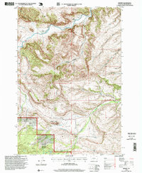
1996 Map of Beehive
USGS Topo · Published 1999About this map
Stillwater River drainage dominates this late-twentieth-century survey, where the small community of Beehive and its nearby Beehive School represent the heart of this rural Montana landscape. The area is characterized by dramatic topographic features, from the prominent Beehive Rock overlooking the river to the deep cuts of Dark Canyon and Magpie Canyon. Local industry and infrastructure are evident through the presence of a Mine and the Lewis Hudson-Fowler Ditch, a vital irrigation line supporting the ranching and agricultural interests of the Dean Basin.
Find a feature on this map
35 named features on this map. Tap any name to fly to it.
Don’t see what you’re looking for? This feature index may not catch every label — zoom into the map to look around manually.
Map Details
Editions of this 1996 Beehive Map
This is the sole edition of this map. No revisions or reprints were ever made.
Other maps of this area

1891 · Big Timber
USGS Topo · 1:125,000

1893 · Big Timber
USGS Topo · 1:125,000

1898 · Granite Mountain District
USGS Topo · 1:125,000

1932 · Nye No 1
USGS Topo · 1:48,000

1932 · Nye No 2
USGS Topo · 1:48,000

1939 · Mt Wood
USGS Topo · 1:62,500

1941 · Mt. Wood
USGS Topo · 1:62,500

1954 · Billings
USGS Topo · 1:250,000

1955 · Sandborn Creek
USGS Topo · 1:24,000
1955 · Wildcat Draw
USGS Topo · 1:24,000