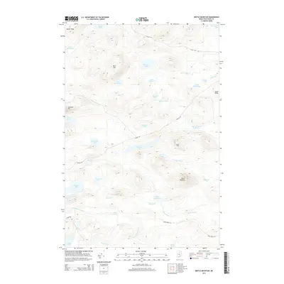
2014 Map of Beetle Mountain
USGS Topo · Published 2014About this map
Beetle Mountain and Grant Mtn overlook a dense network of water bodies and timberlands in this remote section of Piscataquis County. The landscape is defined by the headwaters of the E Br Penobscot River, including the E Br Deadwater and Snake Brook. The topography features numerous glacial ponds and ridges, such as Snowshoe Mtn and Bluffer Ridge, which have long been significant for regional forestry and recreation. Industrial access is provided by unpaved corridors like Pinkham Rd and 43 Mile Rd, which cut through the drainage basins of Big Reed Pond and Munsungan Lake. This map records the hydrography of the North Maine Woods, capturing the relationship between isolated peaks and the complex stream systems of May Brook and Caribou Brook.
Find a feature on this map
40 named features on this map. Tap any name to fly to it.
Don’t see what you’re looking for? This feature index may not catch every label — zoom into the map to look around manually.
Map Details
Editions of this 2014 Beetle Mountain Map
This is the sole edition of this map. No revisions or reprints were ever made.
Other maps of this area

1953 · Telos Lake
USGS Topo · 1:62,500

1954 · Spider Lake
USGS Topo · 1:62,500

1954 · Millinocket Lake
USGS Topo · 1:62,500

1954 · Presque Isle
USGS Topo · 1:250,000

1955 · Traveler Mountain
USGS Topo · 1:62,500

1957 · Telos Lake
USGS Topo · 1:62,500

1958 · Presque Isle
USGS Topo · 1:250,000

1960 · Presque Isle
USGS Topo · 1:250,000

1961 · Spider Lake
USGS Topo · 1:62,500
1975 · Traveler Mountain NW
USGS Topo · 1:24,000